Full-stack web and mobile application for sustainable land management
← Back to HomeDeveloped in collaboration with LandIt and the Câmara Municipal de Mação, this comprehensive platform addresses a critical challenge in Portuguese land management: fragmented land ownership. Many rural areas in Portugal have land divided into extremely small parcels, making efficient agricultural or environmental use nearly impossible.
Our solution provides a complete ecosystem for landowners, operators, administrators, and municipal representatives to consolidate, manage, and optimize land usage for economic, cultural, and environmental benefits. The platform features both web and mobile interfaces, enabling field operators to work directly on-site while administrators manage operations from the office.
Full system access, user management, report generation, and platform configuration
Oversight of operations, approval workflows, and municipal coordination
View assigned lands, track operations, receive notifications, and monitor progress
Execute operations, upload GPX data, share photos, record observations, mark completion
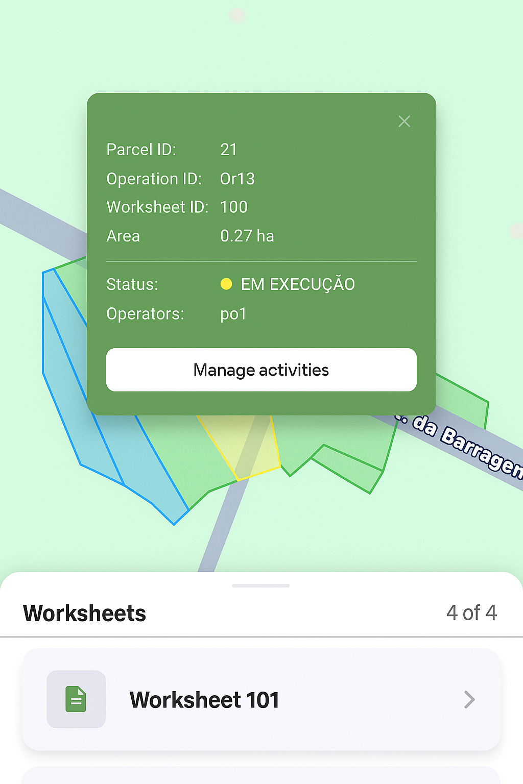
Field operators use the mobile app to navigate land parcels, record real-time data, and document their work. The map interface displays imported GeoJSON worksheets, allowing operators to see exact boundaries and operational areas.
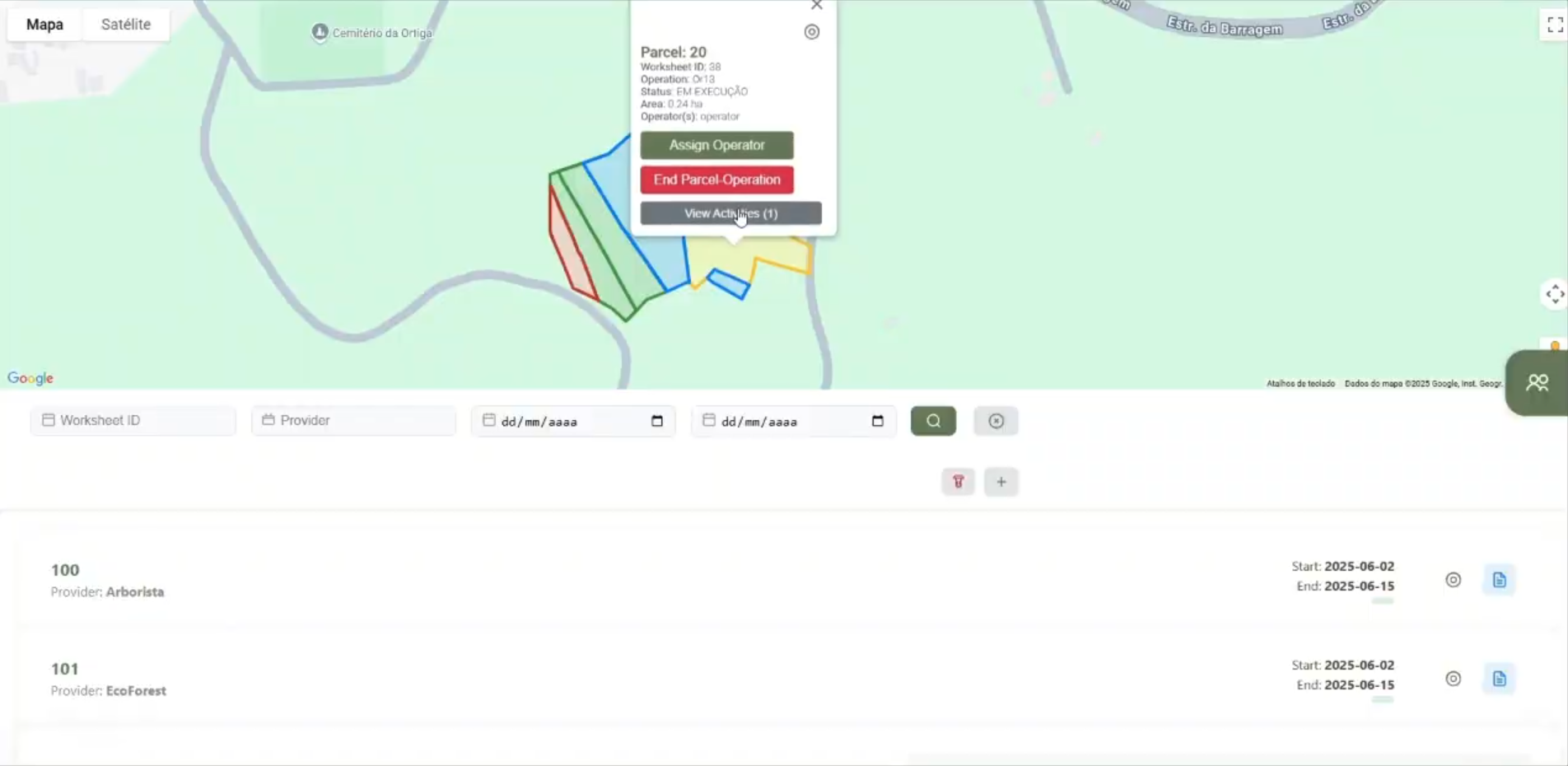
The web platform provides administrators and representatives with a comprehensive view of all land parcels and ongoing operations. GeoJSON worksheets imported from municipal systems are visualized on interactive maps, enabling efficient territory management.
The admin interface provides a centralized hub for managing all aspects of the platform. From this dashboard, administrators can access user management tools, send notifications, monitor system activity, and configure platform settings.
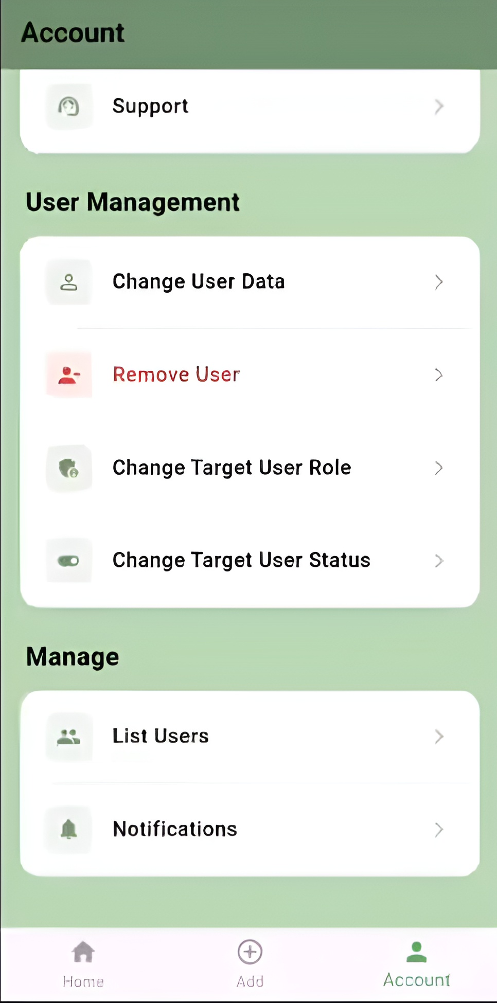
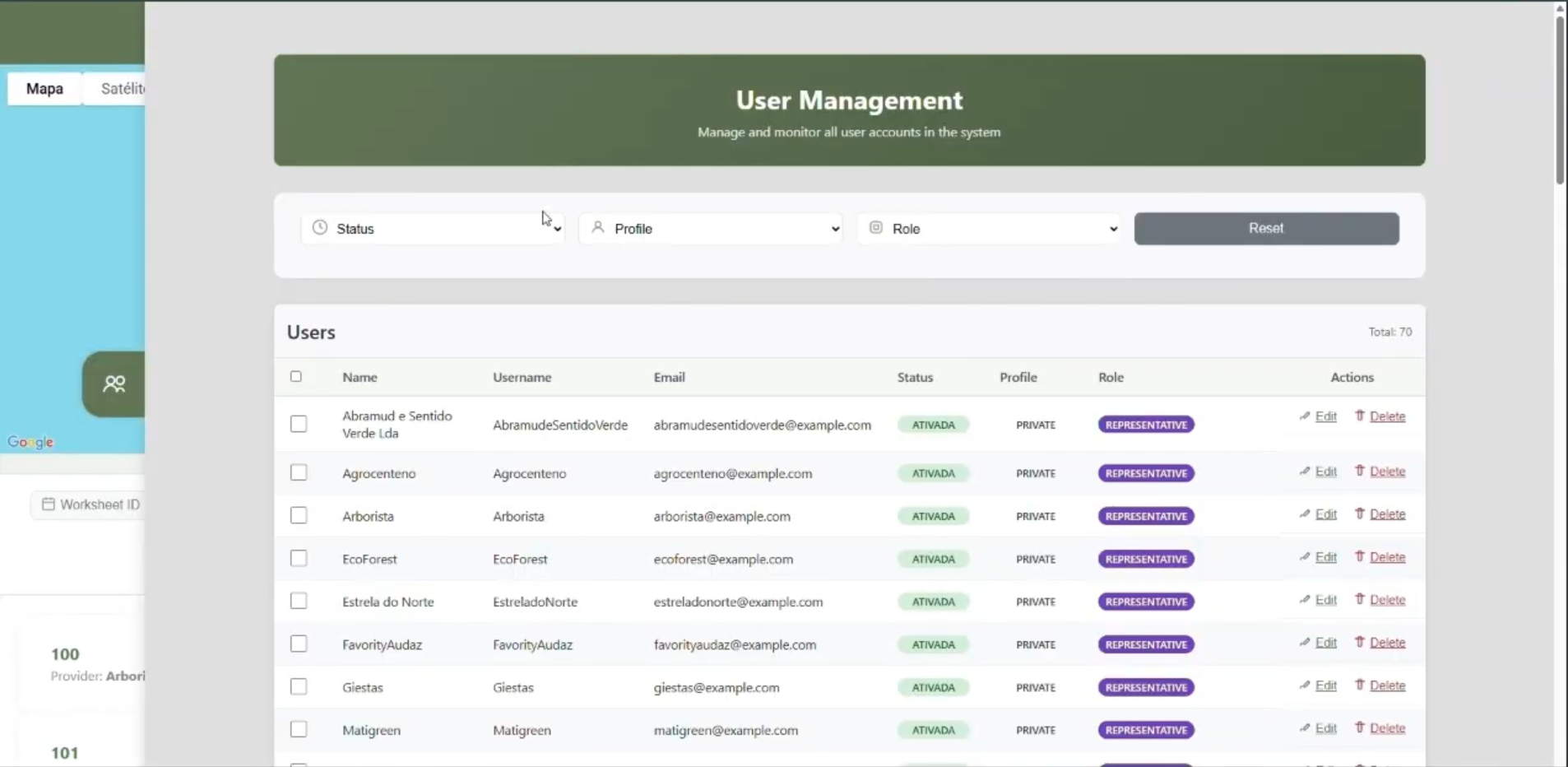
Administrators can create, manage, and monitor all platform users with role-based access control. The system supports multiple user types, each with specific permissions tailored to their responsibilities.
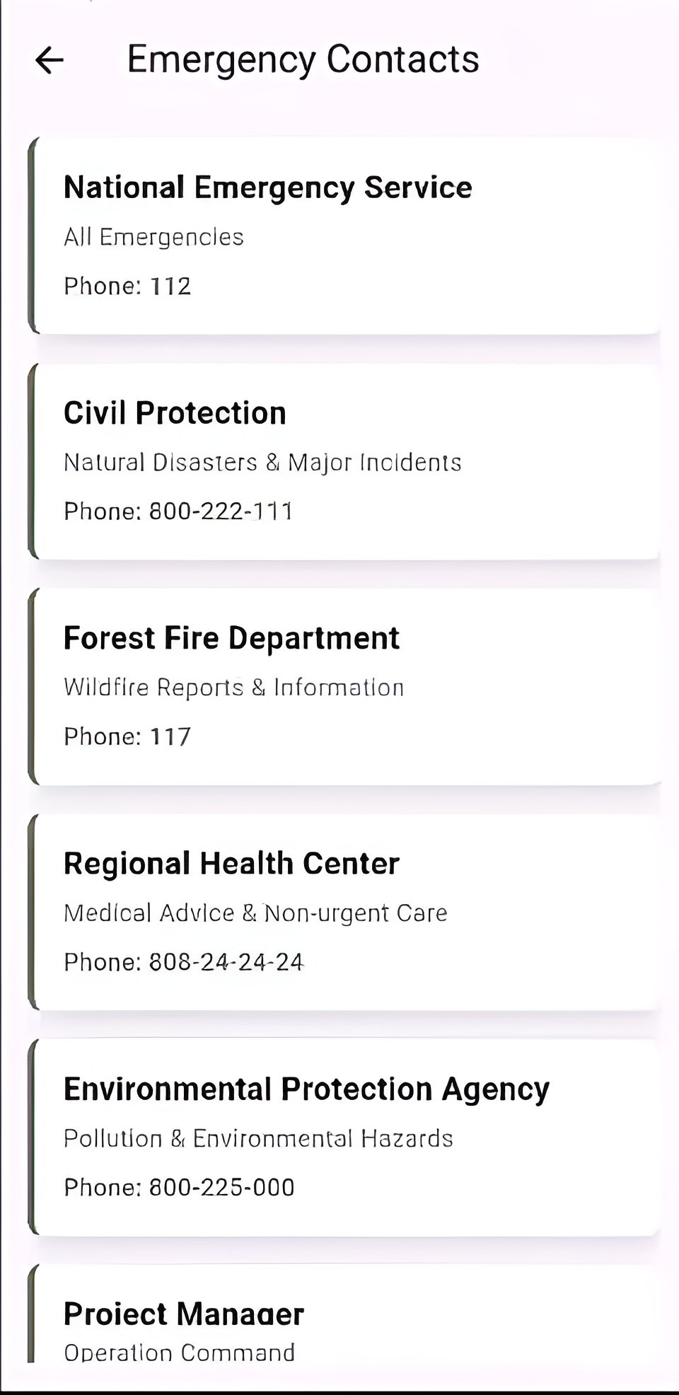
Access your most important emergency numbers instantly with one tap.
Work in areas like this can lead to dangerous situations. Always have a plan and know who to call.
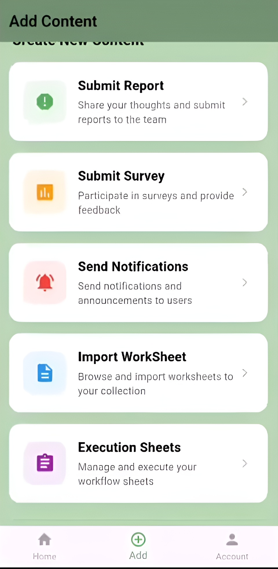
Participate in quick feedback surveys to help improve the platform and share your experience.
Stay informed with instant alerts for system updates, security events, and personalized reminders.
Generate and review activity or usage reports, exportable as PDF or CSV for detailed analysis.
Implemented JWT-based authentication with persistent cookies for seamless user experience. The token system ensures secure communication between client and server while maintaining user sessions across app restarts. Role-based access control (RBAC) via JWT-tokens restricts features and data based on user permissions.
Developed a robust GeoJSON import system that processes worksheets from municipal databases, validates geometry data, and renders complex land parcels on interactive maps. The system handles large datasets efficiently, supporting thousands of parcels without much performance degradation.
Field operators can upload GPX tracks from GPS devices, which are parsed, validated, and displayed on maps alongside operation data. This provides accurate records of work performed and enables verification of completed operations.
One major challenge was handling the complexity of fragmented land ownership data from municipal systems. We solved this by creating a flexible GeoJSON parser that could adapt to different data formats and validate geometries before import.